|
|
|
I have trekked in the Himalayas in India
and Nepal on five occasions as follows: 1987 - Nepal: Khumbu & Annapurna
foothills; 1988 - Kashmir & Ladakh: Himalayan Traverse via Warvan Valley, Suru Valley &
Kanji La; 1995 - Sikkim: Goecha La trek; 2016 - Uttarakhand: Valley of the
Flowers, Hemkund, Kuari Pass trek, Rupkund trek; and 2018 - Nepal: Gokyo Ri
& Renjo La trek. A selection of photographs from these trips is contained
below. Click on the thumbnails to see larger images:
NEPAL:
|
|
|
|
|
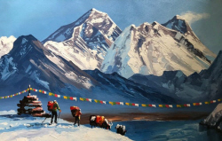
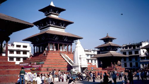
Durbar Square - Kathmandu. My first trip to the Himalayas was in March 1987 on a month long trip in Nepal with Australian Himalayan Expeditions (now World Expeditions). I did an eight day trek in the Everest region, walking from Lukla up to Thyangboche Monastery via Namche Bazaar, an eight day trek in the Annapurna region from Pokhara to Ghorepani, a few days amongst the wildlife in Chitwan National Park and sightseeing around the streets and temples of Kathmandu. |
|
|
|
|
|
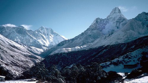
Mt Everest, Nuptse, Lhotse and Ama Dablam from Thyangboche Monastery. We walked from Namche to Thyangboche in cloud and snow and didn't see any views. The next day we awoke to a perfect morning in a snow-covered landscape with huge peaks all around. We spent the day at Thyangboche admiring the awesome scenery. |
|
|
|
|
|
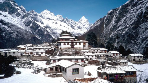
Thyangboche Monastery. |
|
|
|
|
|
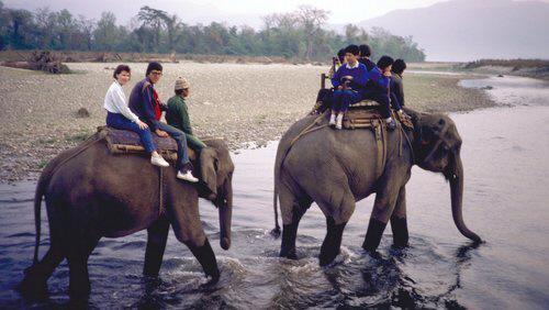
Early morning elephant ride at Chitwan National Park. After the Everest Trek we spent a few days at Chitwan Jungle Lodge down on the plains close to the Indian border. We saw monkeys, rhinoceros, buffalo, deer and peacocks, but no tigers. |
|
|
|
|
|
At the start of the Annapurna trek, with the Annapurna range in the background. |
|
|
|
|
|
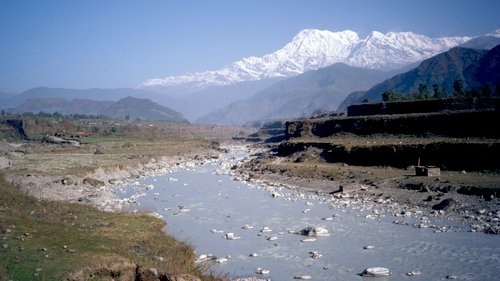
The Seti River near Pokhara. The Annapurna Range rising high above forms a fantastic backdrop. |
|
|
|
|
|
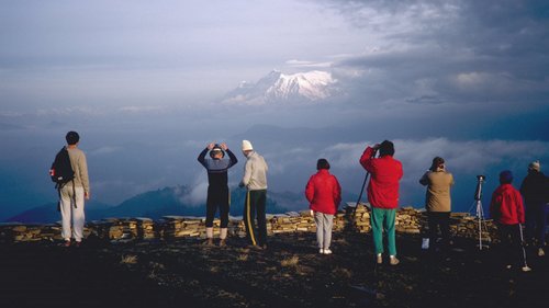
Our second trek started from Pokhara and headed west along the foothills up to Ghorepani, where we visited Poon Hill with its great mountain views. |
|
|
|
|
|
Panorama of the Annapurna massif from Poon Hill, including Annapurna, Annapurna South and Machapuchare. |
|
|
|
|
|
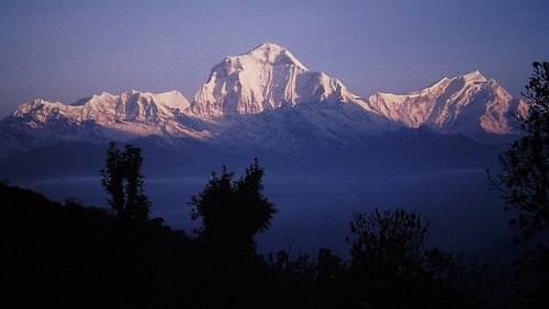
Dhaulagiri and Kali Gandaki valley at sunrise - Annapurna region. |
|
|
|
|
|
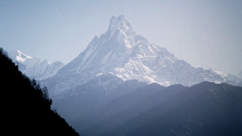
Machapuchare peak. From Ghorepani we headed back to Pokhara via Gandrung and Dhampus, with Annapurna South and Machapuchare dominating the view. |
|
|
|
|
|
Campsite on the Annapurna trek amongst the rhododendrons. The most important thing was the toilet tent, which gets a lot of use by all the trekkers. |
|
|
|


KASHMIR & LADAKH:
|
|
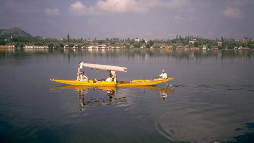
Shikara on Nagin Lake in Srinagar, Kashmir. My second trip to the Himalayas was in July / August 1988 when I did a 33 day trip with World Expeditions to Kashmir in northern India. Our trek was called the ‘Himalayan Traverse’ Trek, a 19 day walk which went from the forests and greenery of Kashmir, across the Himalayas over glaciers, to the high altitude desert of Ladakh. As well as the dramatic change in landscape, there was also a change in culture - from Islam and mosques in Kashmir to Buddhism and monasteries in Ladakh. The trek crossed six high passes, the highest being the Kanji-La at about 17500'. Before and after the trek we spent a few days on the houseboats in Srinagar, as well as sightseeing in Delhi, Leh and Agra. |
|
|
|
|
|
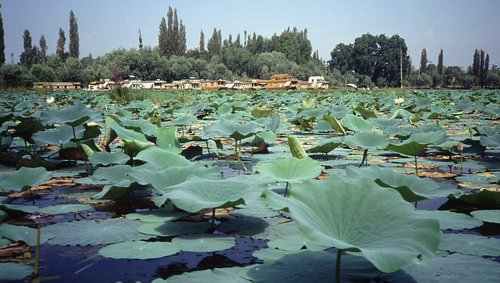
Lotus plants on Nagin Lake. |
|
|
|
|
|
Our houseboats on Nagin Lake in Srinagar. A beautiful place, that subsequently descended into conflict after we were there. We spent a few days on the houseboats and visited the Nishat Gardens on Dal Lake, the Hazratbal Mosque and watched the local life pass by on the lake. The houseboats were luxurious and a great place to relax, providing you could escape the locals who kept paddling up to our boat on their shikaras trying to sell their goods. |
|
|
|
|
|
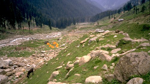
Campsite among the pine forests in Kashmir. Our trek started in the village of Lehinvan, a three hour drive from Srinagar at the eastern side of the Kashmir Valley, then continued over the Margan Pass into the Warvan Valley. |
|
|
|
|
|
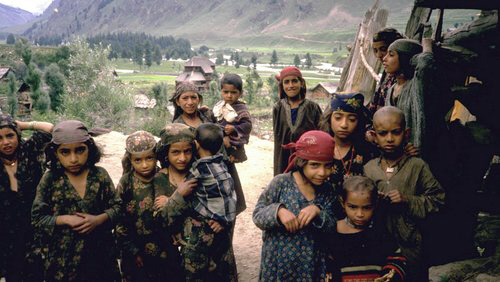
Kashmiri children in a village in the Warvan Valley. |
|
|
|
|
|
Approaching the main Himalayan range in the upper Warvan Valley near Humpet. We spent a week walking up the Warvan Valley through remote villages towards the Bhoktal Glacier. |
|
|
|
|
|
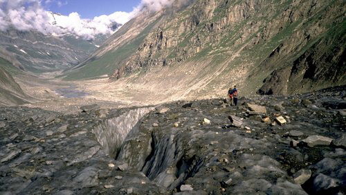
Climbing the Bhoktal Glacier. We spent a day climbing over the Bhoktal Glacier and Bhoktal Pass to the north side of the Himalayas, after which the landscape became more barren. |
|
|
|
|
|
At the upper reaches of the Bhoktal Glacier, heading towards the Bhoktal Pass. |
|
|
|
|
|
Our group on Bhoktal Pass at 14500'. |
|
|
|
|
|
We spent a few days walking eastwards up the Suru Valley past Nun and Kun - the highest mountains in Indian Kashmir. |
|
|
|
|
|
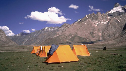
Campsite in the Suru Valley. |
|
|
|
|
|
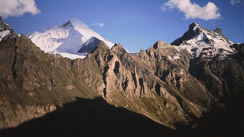
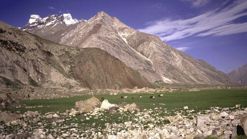
Nun-Kun massif from Shafat in the Suru Valley. |
|
|
|
|
|
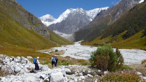
Typical scenery along the Suru Valley. |
|
|
|
|
|
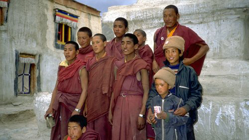
Monks at Rangdum Monastery, close to Zanskar. Buddhist prayer flags and chortens became more prevalent the further we went into Ladakh. |
|
|
|
|
|
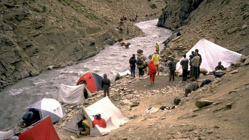
River crossing and campsite below the Kanji La. |
|
|
|
|
|
We crossed our fourth and highest pass over the Zanskar Range - the Kanji La - at around 17500' above sea level. This involved a 4000' ascent and 5000' descent, a very long day. From the pass the views to the south were of the pink coloured mountains of Zanskar and to the north, looking into Ladakh and Pakistan, were the gorges and the distant snow peaks of the Karakorum. K2 is visible from this pass but we didn't see it. |
|
|
|
|
|
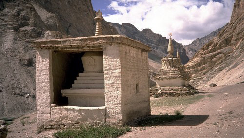
Buddhist chortens near Kanji village in Ladakh. |
|
|
|
|
|
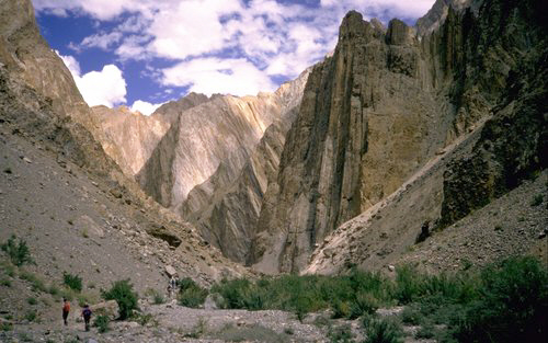
Towards the end of the trek we walked through the extremely spectacular Shilakong Gorge. |
|
|
|
|
|
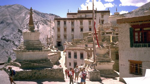
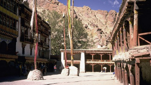
Lamayuru Monastery. We finished our trek at this monastery then boarded a bus for the six hour drive along the Indus River valley to Leh. |
|
|
|
|
|
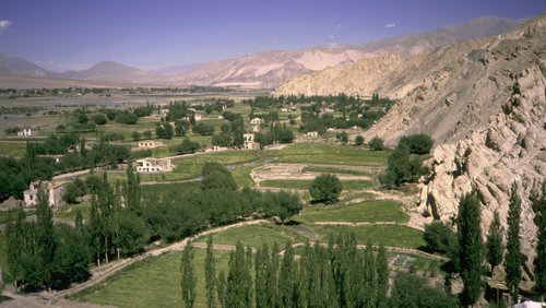
The Indus River valley near Leh. |
|
|
|
|
|
Thikse Monastery near Leh. |
|
|
|
|
|
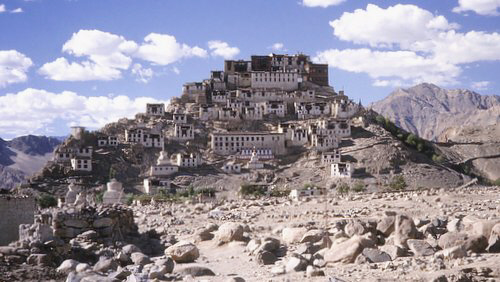
Hemis Monastery is located in a side valley 15 miles from Leh and is the most important monastery in Ladakh and the site of a famous masked dance festival each June. |
|
|
|
|
|
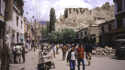
Leh streetscene. The eight storey Leh Palace, which overlooks the town, was damaged on one side as a result of invasions last century, and provided a great place to view the town. We spent two days in Leh, visiting the surrounding monasteries - such as Shey, Stok, Tikse and Hemis - and exploring the shops and markets of the town. |
|
|
|
|
|
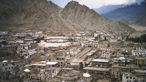
Overlooking Leh. |
|
|
|
|
|
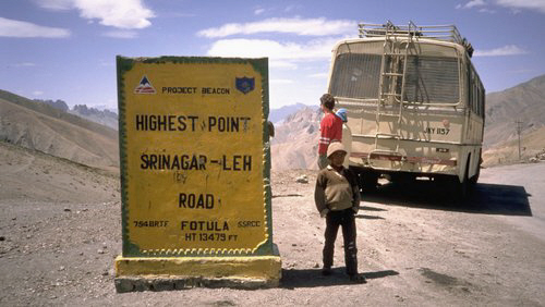
From Leh we had a two day drive back to Srinagar via Kargil, Dras, the Zoji-La and Sonomarg. |


SIKKIM:
|
|
In April 1995 I did a ten day trek in western Sikkim from Yuksom to the Goecha-La pass just below Kanchenjunga - the world's third highest mountain. The trek was organised by The Trekking Company, based in Canberra. After flying to Calcutta, our group travelled by train and jeep to Darjeeling where we spent a few days walking around the city visiting various sights such as the Himalayan Mountaineering Institute, Snow Leopard Breeding Centre, Tibetan Self Help Centre, Planter's Club, Dali Monastery and the Toy Train. This photo shows Sheila, our host, with the flags carried by Tenzing on the first ascent of Everest. Tenzing's family were getting the flags framed. |
|
|
|
|
|
The famous Toy Train in Darjeeling. |
|
|
|
|
|
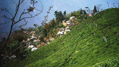
Tea plantations and villages on the steep slopes below Darjeeling, enroute to Sikkim. |
|
|
|
|
|
We began the trek in the village of Yuksom. The first stage of the trek passed through lush forest high above the Prek Chu River before beginning the steep ascent to the Dzongri plateau. |
|
|
|
|
|
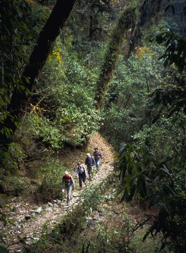
Walking through the forest below Dzongri. The higher we went the more the vegetation changed from jungle to pine and rhododendron forest. Whereas in Nepal one often see villages, people and terraced hillsides when trekking, this was a more natural, untouched area by comparison. |
|
|
|
|
|
View of the Himalayas from a hill above our campsite at Dzongri. Kanchenjunga is at the back right of the photo. This area provided great views of the surrounding mountains and there were many herds of large yak grazing nearby. |
|
|
|
|
|
The impressive Mt Pandim dominated the trek for most of the way. |
|
|
|
|
|
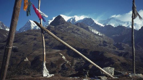
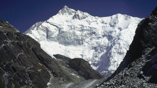
Approaching the Goecha-La pass (16,500') with the huge south face of Kanchenjunga beyond. The top of Kangchenjunga is still almost 12000' higher than the pass! |
|
|
|
|
|
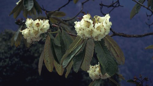
White rhododendrons on the Goecha-La trek in Sikkim. |


UTTARAKHAND:
|
|
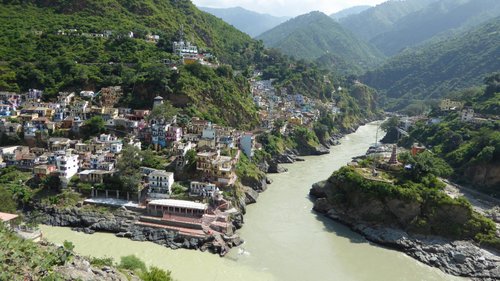
My fourth Himalayan trip was in Sept/Oct 2016 when I trekked with friends in Uttarakhand in India. We visited Badrinath temple, walked to the Valley of the Flowers and Hemkund Lake, then did both the Kuari Pass and Rupkund treks. We took a train from Delhi to Haridwar to see the nightly Ganga Aarti ceremony, then continued into the mountains along the Ganges River valley. At Deoprayag we were able to look down on the confluence of two rivers which forms the official start of the Ganges. |
|
|
|
|
|
The mountains in Uttarakhand are very steep and unstable, with extensive erosion and landslide damage. Many sections of road with overhanging boulders are very hairy and dangerous, especially during the monsoon. |
|
|
|
|
|
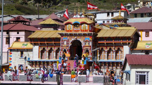
Badrinath Temple. We spent an acclimatisation day visiting Badrinath, a town located at 3300m close to the Tibetan border. |
|
|
|
|
|
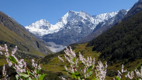
The Valley of the Flowers. We trekked from Govind Ghat to the village of Gangaria from where we did day trips to the Valley of the Flowers and Hemkund temple. The flowers in the valley mainly occur during the monsoon so there were not many flowers in bloom whilst we were there. |
|
|
|
|
|
The upper reaches of the Valley of the Flowers, surrounded by 6000m peaks. |
|
|
|
|
|
The steep and windy trail on the 1200m climb from Gangaria to Hemkund. |
|
|
|
|
|
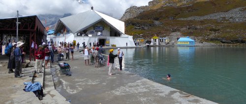
Hemkund is an important Sikh temple and shrine situated on the edge of Hemkund Lake at 4300m altitude with a great view of the surrounding mountains. |
|
|
|
|
|
Nanda Devi peak, at 7818m, the highest peak completely within India. We began the Kuari Pass trek at the Auli ski resort, just above the town of Joshimath. On the grassy slopes higher up we had good views of Nanda Devi, Dunagiri and other peaks surrounding the Nanda Devi Sanctuary. Then the cloud closed in and that was our last view of the peak for the remainder of the trek. |
|
|
|
|
|
The hillsides surrounding the village of Pana were full of colourful crops, the most spectacular being the purple colour amaranth plant. |
|
|
|
|
|
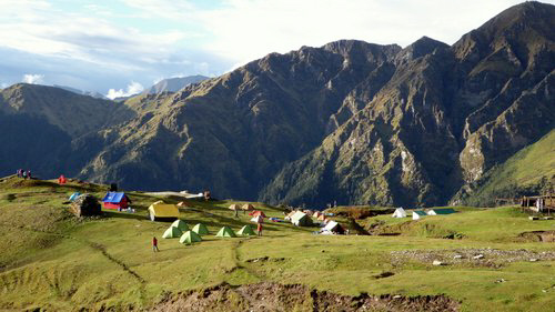
Campsite on the enormous meadow known as Bedni Bugyal, on the Rupkund trek. |
|
|
|
|
|
The Chaukamba massif at sunrise. |
|
|
|
|
|
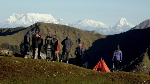
Trekking groups enjoying the early morning view over the Himalayas from Bedni Bugyal. To the north is the sharp peak of Nilkanth and further west is the enormous Chaukamba massif close to Gangotri. |
|
|
|
|
|
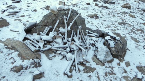
From the Bhagu Basa campsite at 4100m we had an early start to reach Rupkund Lake high above. The lake is famous for the large number of human bones, supposedly from a group of pilgrims who perished in the area centuries ago. |
|
|
|
|
|
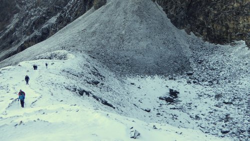
Climbing up the snowy trail from Rupkund Lake, looking more like a pomd, towards the Junagarli Pass. |
|
|
|
|
|
The 5000m high Junagarli Pass provides great views of the entire west face of Trisul, the first 7000m peak to be climbed in 1912, and of Nanda Ghunti. |


NEPAL:
|
|
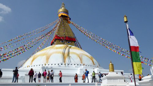
In Oct/Nov 2018 I did my most recent Himalayan trip. the 'Gokyo Ri & Renjo La' trek with World Expeditions. This trek provided the opportunity to do a more demanding trek in the Everest region, plus see the changes that had occurred from my previous visit 30 years earlier. Before the trek our group spent a day in Kathmandu visiting the Pashupatinath temple complex and Boudhanath stupa. |
|
|
|
|
|
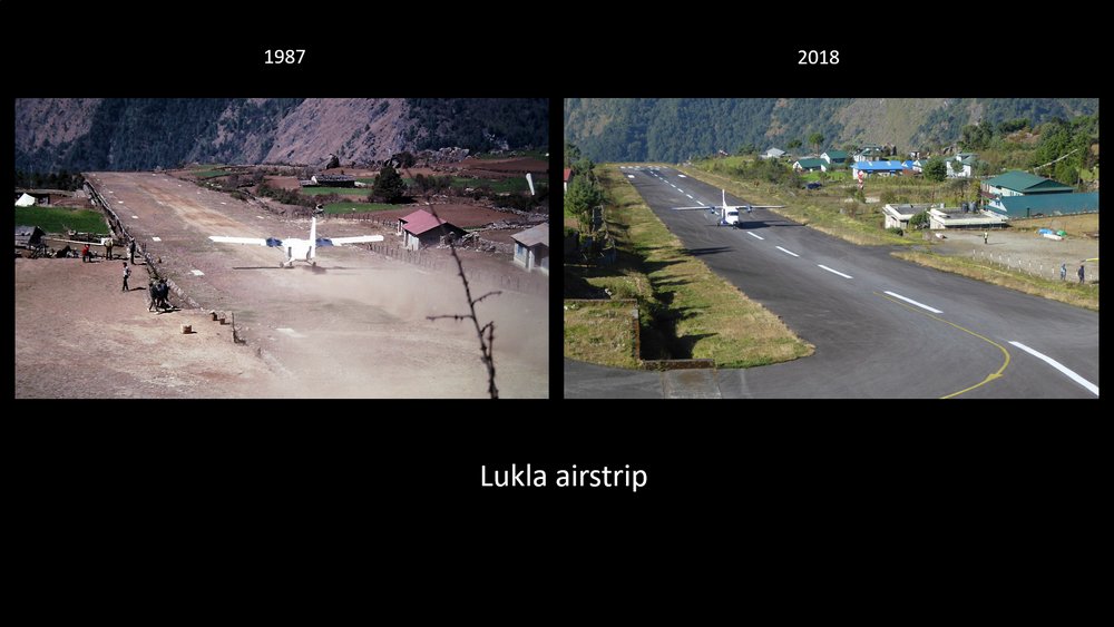
Lukla Airport, the gateway to the Everest region. |
|
|
|
|
|
Comparison photos of Lukla airstrip from my visits in 1987 and 2018. In 1987 Lukla had a bumpy dirt runway and was a much smaller village. Nowadays there are coffee shops, wi-fi and a constant stream of planes and helicopters landing and taking off. |
|
|
|
|
|
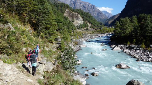
Walking up the western side of the Dudh Kosi River between Ghat and Phakding. |
|
|
|
|
|
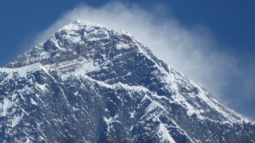
Below Namche Bazaar we got our first view of the top of Mt Everest. |
|
|
|
|
|
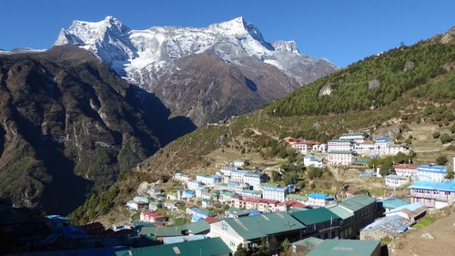
Namche Bazaar and Mt Kongde. |
|
|
|
|
|
Comparison photos of Namche Bazaar in 1987 and 2018. The village is now much larger, with mostly 3 and 4 storey buildings, most having blue painted roofs, many more shops and cafes and outdoor shops, and with many more trekking groups passing through. |
|
|
|
|
|
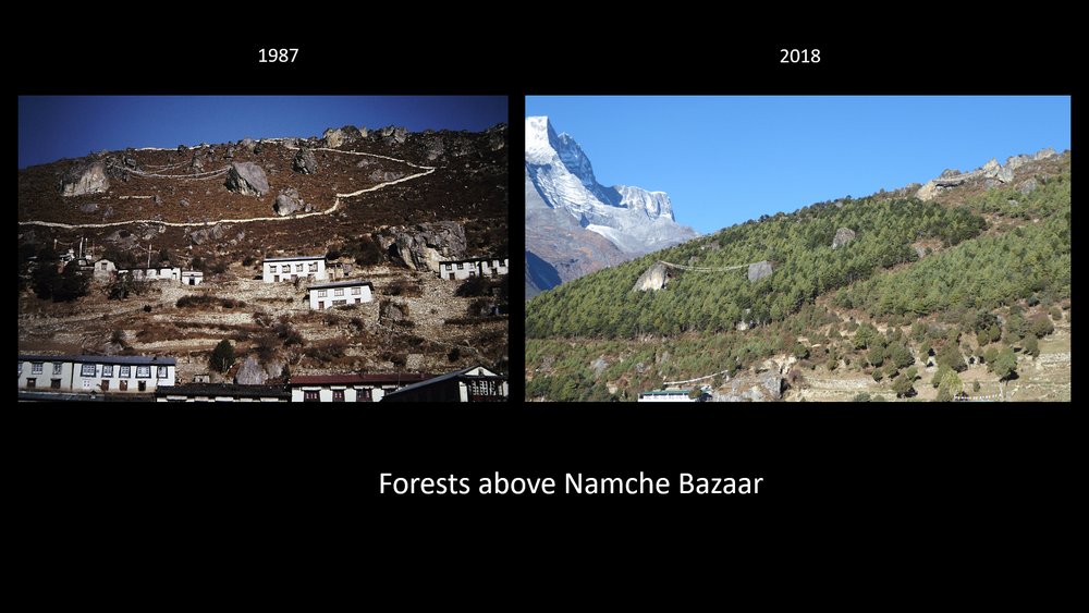
Comparison photos of the slopes surrounding Namche Bazaar in 1987 and 2018. In 1987 parts of the bare slopes had been fenced off for regeneration, and now these slopes are covered by forest. |
|
|
|
|
|
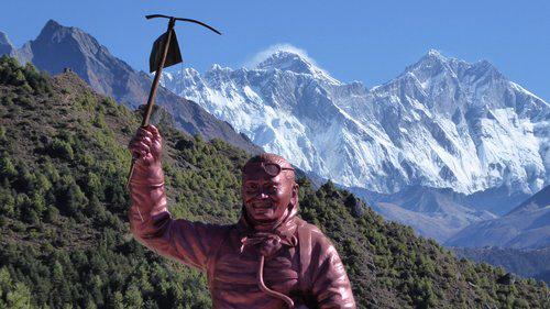
The statue of Tenzing Norgay at the Sagarmatha National Park Visitor Centre, with Mt Everest beyond. |
|
|
|
|
|
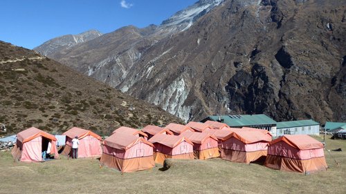
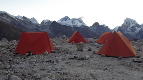
Our campsite at Dole, a village at 4100m in the lower Gokyo Valley. |
|
|
|
|
|
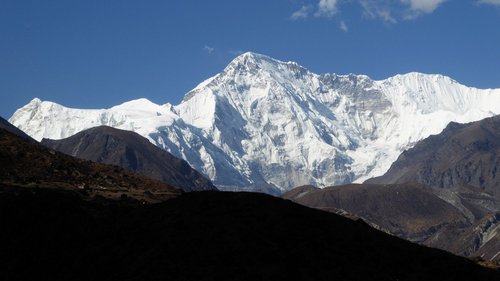
Cho Oyu, the 6th highest peak in the world, at the head of the Gokyo valley. |
|
|
|
|
|
Gokyo village nestled on the shore of Gokyo lake at 4800m altitude. |
|
|
|
|
|
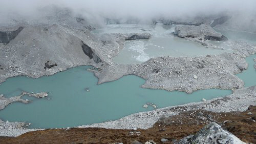
The Nzogumpa Glacier, the longest glacier in Nepal. The surface of the glacier is covered by rubble and dirt and several enormous iceberg covered lakes which have formed in recent years. If this water ever breaks through the ice in the future and rushes down the valley it will cause huge destruction to many villages along the Dudh Kosi valley. |
|
|
|
|
|
Panorama from the top of Gokyi Ri (5357m) of Cho Oyu, in cloud, the Nzogumpa Glacier, Mt Everest, Cholatse, Makalu and Gokyo Lake. |
|
|
|
|
|
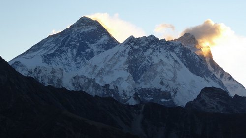
Mt Everest from the top of Gokyo Ri, showing the north and southwest faces. |
|
|
|
|
|
Prayer flags on the summit of Gokyo Ri. |
|
|
|
|
|
Our campsite at 5200m on the plateau below the Renjo La provided an amazing view of Mt Everest. |
|
|
|
|
|
Mt Everest at sunrise. |
|
|
|
|
|
Having breakfast whilst looking at Mt Everest at one of the most amazing campsites I have experienced. |
|
|
|
|
|
The Renjo La (5360m) was the highest point of the trek and provided great views of Mt Everest, the Nzogumpa Glacier, Gokyo village and the third lake. This would be our last good view of Everest on the trek, after which we headed into the Bhote Kosi River valley in a loop that took us via Thame back to Namche Bazaar. |
|
|
|
|
|
A bonus view of Mt Everest on the flight from Kathmandu to Singapore. Our aircraft flew east parallel to the Himalayas providing views of five of the six highest mountains in the world - Cho Oyu, Everest, Lhotse, Makalu and Kangchenjunga. |


![]() Contact "alanlevy
at pcug dot org dot au" for more information.
Contact "alanlevy
at pcug dot org dot au" for more information.
View my other pages: [Home]
[Antarctic Peninsula] [Antarctic
Flight] [Shackleton Odyssey] [South Georgia] [Easter
Island] [Southern Africa] [Galapagos Islands] [Australia]
[Egypt] [Inca Trail] [US National Parks] [China] [Cross Country Skiing Photographs] [US
& Canada National Parks] [Hawaii] [Switzerland]
Page last modified on