|
|
|
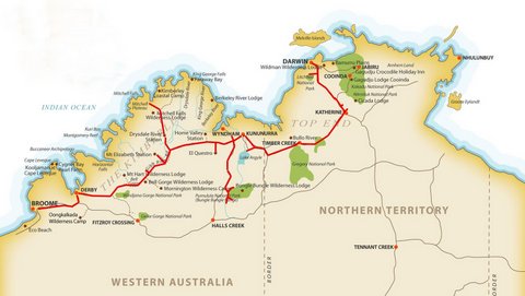
In May 2016 I did a two week trip from Broome to Darwin along the Gibb River Road with Kimberley Wild Expeditions. The trip also visited Mitchell Falls, the Bungle Bungles, Ord River, Katherine Gorge and Litchfield National Park. A selection of photographs from this trip is contained below. Click on the thumbnails to see larger images:
|
|
|
|
|
This map shows the route of the tour from Broome, along the Gibb River Road, up to Mitchell Falls, across to Kununurra and the Bungle Bungles, then into the Northern Territory to Darwin. |
|
|
|
|
|
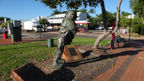
I had an afternoon to explore Broome before the start of the tour, where I was able to see the pearl diver statues in the main street, walk out onto Settlers Jetty, and visit the Chinatown sector plus the
historic Sun Theatre. |
|
|
|
|
|
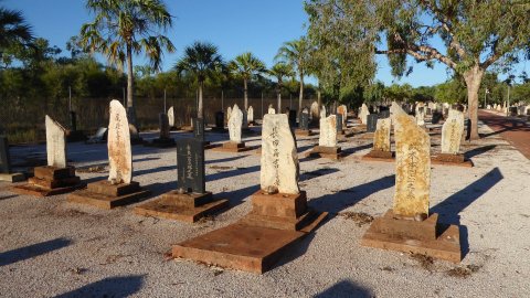
The Japanese Cemetery on the outskirts of Broome. |
|
|
|
|
|
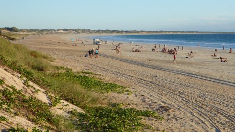
Tourists on Cable Beach late in the day. I resisted going on the camel ride along the beach. |
|
|
|
|
|
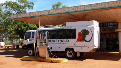
The next morning I was picked up from my hotel in Broome and joined the rest of the tour group. We started the journey by heading east towards Derby, stopping at the Willare Bridge Roadhouse for morning tea. |
|
|
|
|
|
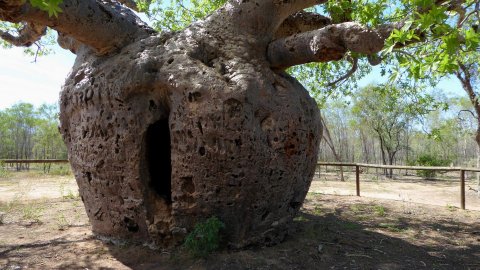
The Boab Prison Tree on the outskirts of Derby. This huge
tree was supposedly used to house aboriginal prisoners. |
|
|
|
|
|
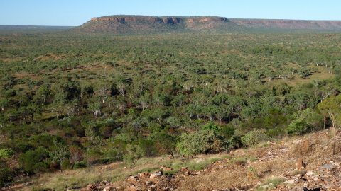
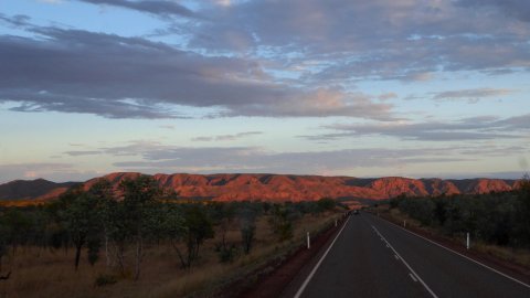
From Derby we headed east along the Gibb River Road through a landscape of savannah, boab trees and flood
plains, then later in the afternoon through the picturesque King Leopold Ranges, which have recently been renamed. |
|
|
|
|
|
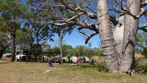
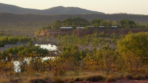
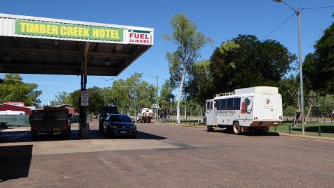
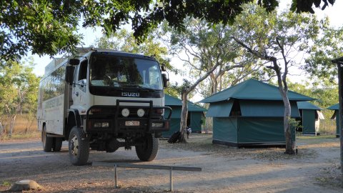
After a long first day we arrived at the Mt Barnett Roadhouse in the dark and camped at the nearby Manning River campground. |
|
|
|
|
|
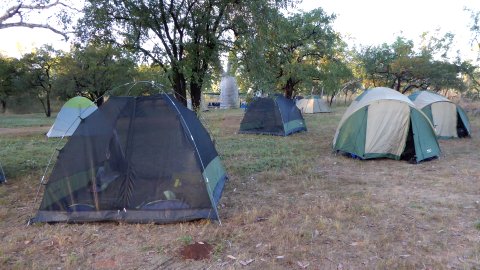
Our tents at the Manning River Campground. |
|
|
|
|
|
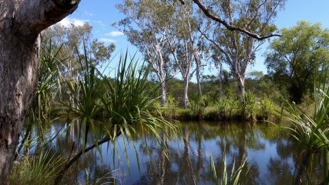
The next morning we walked 4km to the Manning Gorge where we swam in the beautiful waterhole below the falls. |
|
|
|
|
|
Boab tree at the Manning River Campground. |
|
|
|
|
|
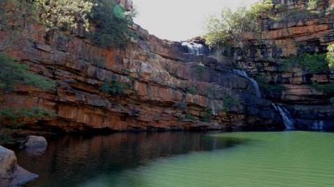
Adcock Gorge. |
|
|
|
|
|
Galvans Gorge. |
|
|
|
|
|
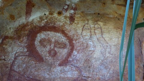
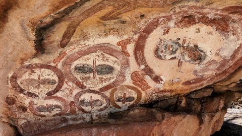
Windjana paintings at Galvans Gorge. |
|
|
|
|
|
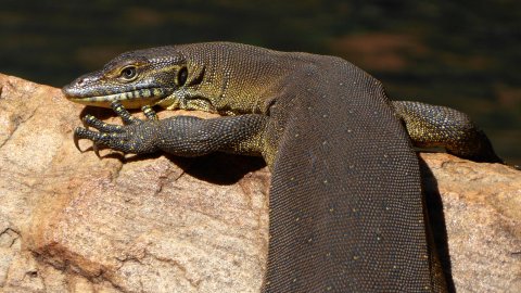
Monitor at Galvans Gorge. |
|
|
|
|
|
Frill necked lizard on a tree at Mt Elizabeth Station, which was our next overnight stop. |
|
|
|
|
|
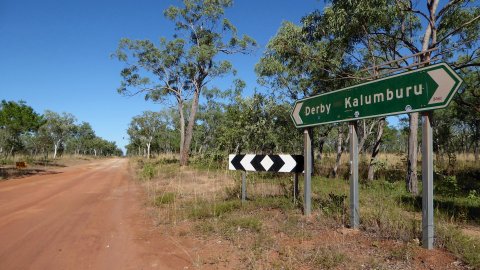
The junction of the Gibb River Road and Kalumburu Road. From here we headed north to Drysdale River Station then on to the Mitchell Falls campground. |
|
|
|
|
|
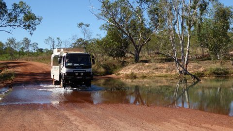
Crossing the Gibb River. |
|
|
|
|
|
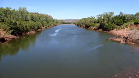
The King Edward River, enroute to Mitchell Falls. |
|
|
|
|
|
Having lunch next to the King Edward River. |
|
|
|
|
|
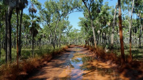
The road across the Mitchell Plateau was very rough, with corrugations and large puddles from recent rain.
The road passed through a mixture of eucalypts and palm trees, and along ridge tops with occasional views to distant hills in both directions. |
|
|
|
|
|
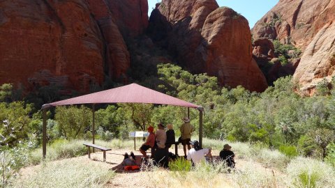
The next day we walked 3.5km from the campground to Mitchell Falls following a good trail
through patches of rainforest and past aboriginal paintings, and then crossed just above Big Merten Falls which
drops into a spectacular narrow canyon. |
|
|
|
|
|
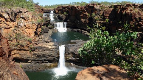
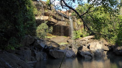
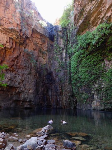
Mitchell Falls. |
|
|
|
|
|
Mitchell Falls. |
|
|
|
|
|
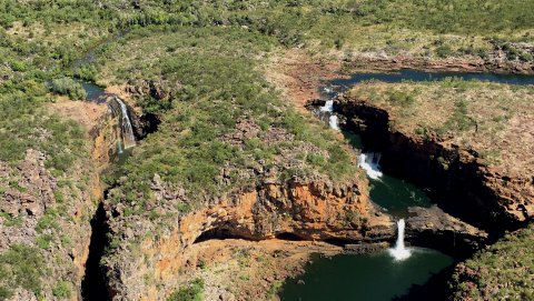
An aerial view of Mitchell Falls. Some of our group opted for a short helicopter ride from the falls back to the campground, whilst the rest of us preferred the walk back. |
|
|
|
|
|
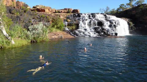
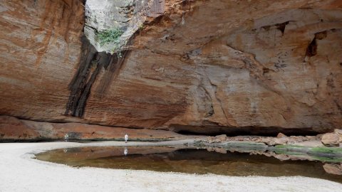
Little Merten Falls is a beautiful spot, with good swimming and having some great rock
paintings on the rock walls under the waterfall. |
|
|
|
|
|
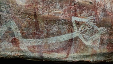
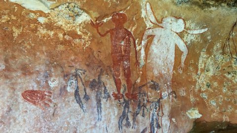
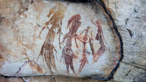
From Mitchell Falls we headed back to the King Edward River and visited Munurru, an aboriginal rock art area containing Windjana paintings, Bradshaw
paintings, human skulls in caves, and animal and thylacine paintings. |
|
|
|
|
|
Viewing the rock art at Munurru. |
|
|
|
|
|
Bradshaw paintings. |
|
|
|
|
|
Bradshaw paintings. |
|
|
|
|
|
Windjana paintings. |
|
|
|
|
|
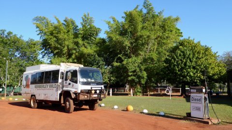
Our vehicle at the Drysdale River Station. |
|
|
|
|
|
We stopped for tea and scones at Ellenbrae Station. |
|
|
|
|
|
Crossing the Pentecost River with the Cockburn Range in the background. As we approached El Questro station the scenery became more spectacular. |
|
|
|
|
|
Boab tree at sunset. |
|
|
|
|
|
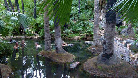
The Zebedee Springs at El Questro station. The area contains livingstonia palms and warm springs situated below a large rock face. |
|
|
|
|
|
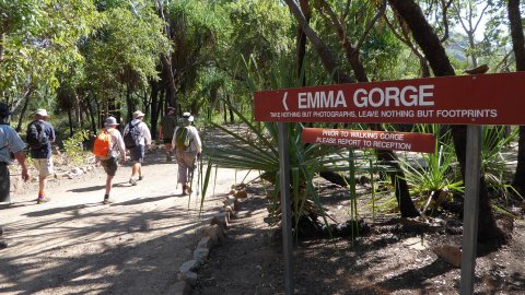
Commencing the walk to Emma Gorge. |
|
|
|
|
|
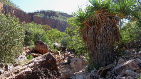
Inside Emma Gorge. |
|
|
|
|
|
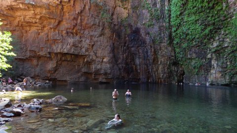
Swimming at Emma Gorge. |
|
|
|
|
|
The Emma Gorge swimming hole was very spectacular, with high cliff walls rising above, plus ferns and dripping water. |
|
|
|
|
|
Emma Gorge. |
|
|
|
|
|
Rippled rock on the Emma Gorge trail. |
|
|
|
|
|
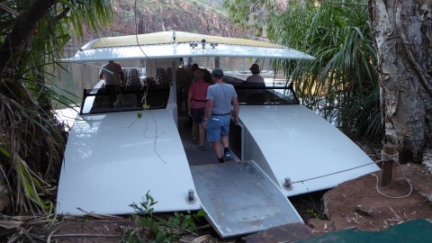
We did an afternoon cruise on the Chamberlain River. |
|
|
|
|
|
The spectacular and colourful rock walls in the Chamberlain Gorge. One highlight was feeding and viewing the archer fish in the water. These fish squirt water onto twigs to knock insects into the water, however they also are
attracted to shiny objects and so were squirting water at our cameras. |
|
|
|
|
|
Chamberlain River. |
|
|
|
|
|
A distant view of the upmarket and very expensive El Questro Homestead. |
|
|
|
|
|
Swimming at The
Grotto, a popular swimming hole in a shaded gorge north of Kununurra, on the road to Wyndham. |
|
|
|
|
|
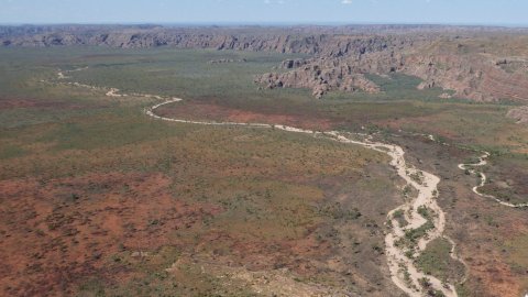
Driving south on the Great Northern
Highway from Kununurra to Purnululu National Park. |
|
|
|
|
|
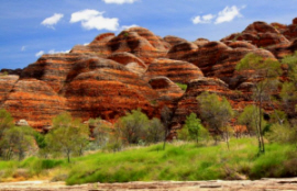
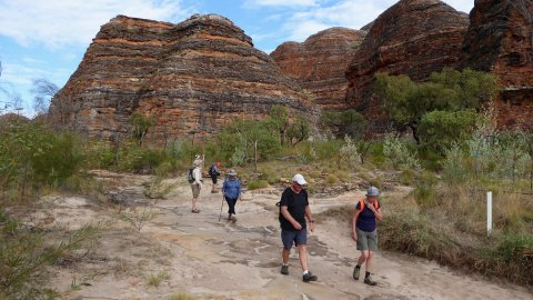
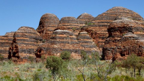
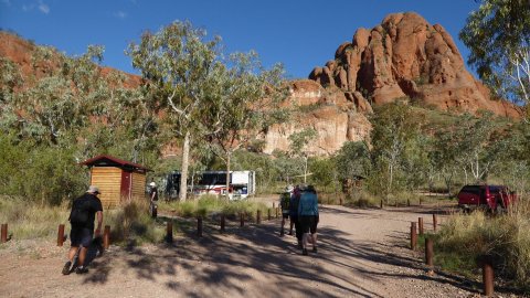
We spent two days exploring the Bungle Bungles. |
|
|
|
|
|
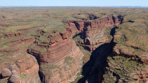
Cathedral Gorge, an impressive
ampitheatre hidden amongst the beehive domes. |
|
|
|
|
|
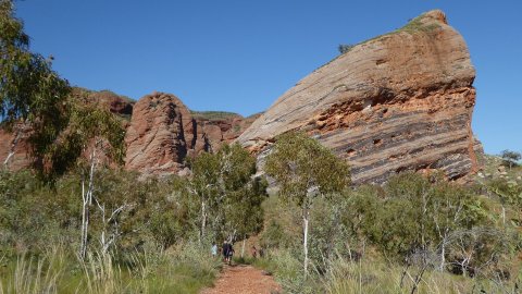
Bungle Bungle scenery. |
|
|
|
|
|
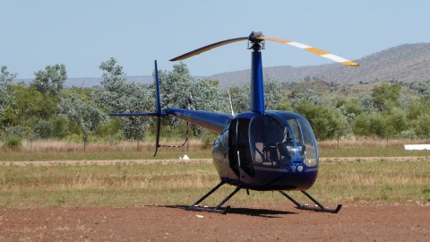
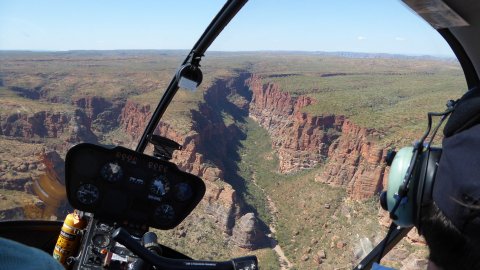
I did a 30 minute helicopter flight over the Bungle Bungles. |
|
|
|
|
|
Flying over a gorge in the Purnululu Range. |
|
|
|
|
|
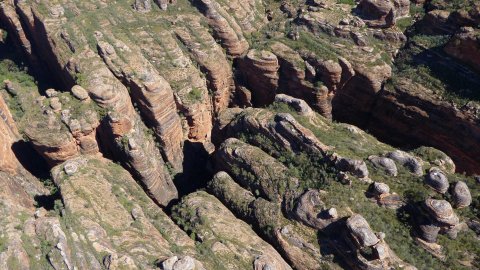
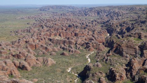
Purnululu Range rock formations. |
|
|
|
|
|
Gorge within the Purnululu Range. The doors-off flight enabled clear views of the scenery. |
|
|
|
|
|
Purnululu Range. |
|
|
|
|
|
Above the beehive domes of the Purnululu Range. |
|
|
|
|
|
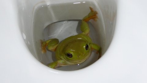
A green tree frog sitting in our toilet bowl! |
|
|
|
|
|
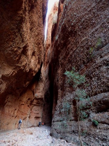
Commencing the walk into Echidna Gorge, on the northern side of the Purnululu Range. |
|
|
|
|
|
The walk into Echidna Gorge goes past Livingstonia palms into a narrow slot canyon similar to Stanley
Chasm. It is an amazing canyon, with conglomerate walls and a dark, cool environment compared to the heat and
sunshine outside. |
|
|
|
|
|
Watching the sunset over the Purnululu Range. |
|
|
|
|
|
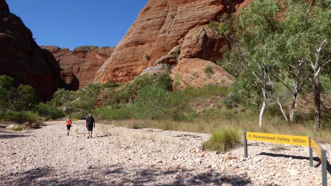
The Homestead Valley trail at Purnululu National Park. |
|
|
|
|
|
The Homestead Valley trail. |
|
|
|
|
|
Heading towards Homestead Valley. |
|
|
|
|
|
Inside Homestead Valley. |
|
|
|
|
|
Livingstonia palms near Homestead Valley. |
|
|
|
|
|
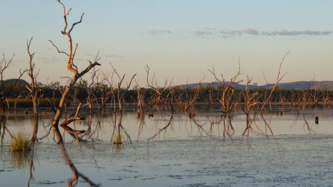
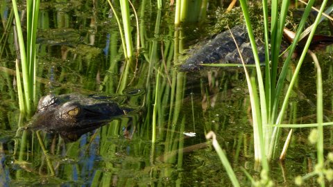
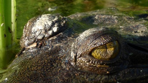
We returned to Kununurra and stayed for
two nights at the Kimberleyland Caravan Park. |
|
|
|
|
|
Small freshwater crocodile in the lake close to our campsite. |
|
|
|
|
|
Closeup of the crocodile. |
|
|
|
|
|
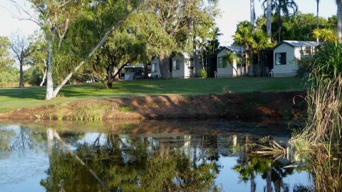
Campground and lake foreshore at Kununurra. |
|
|
|
|
|
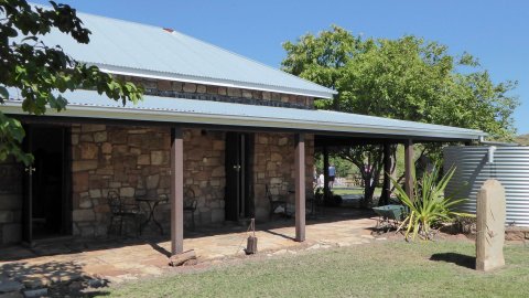
Durack Homestead near Lake Argyle. |
|
|
|
|
|
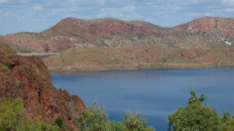
Lake Argyle. |
|
|
|
|
|
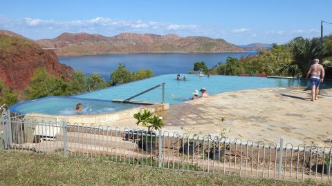
Infinity pool at Lake Argyle Village. |
|
|
|
|
|
View of the Ord River from the top of the dam wall. |
|
|
|
|
|
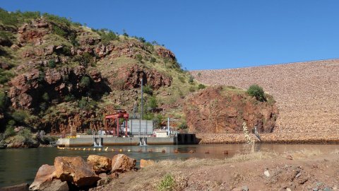
Ord River Dam. From here we went on a 55km, four hour jet boat trip along the Ord River back to Kununurra. |
|
|
|
|
|
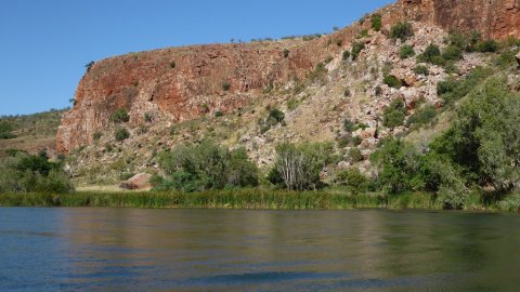
Ord River Gorge scenery. |
|
|
|
|
|
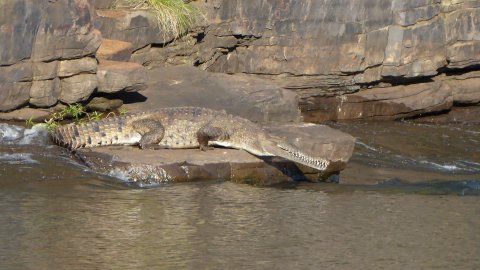
Freshwater crocodile on the banks of the Ord River. |
|
|
|
|
|
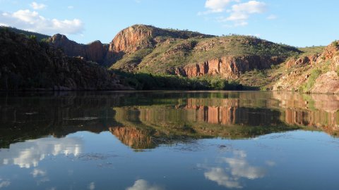
Ord River reflection. |
|
|
|
|
|
We stopped for afternoon tea at a shaded rest stop ashore and had pumpkin scones, tea and cake. Of interest was the nearby rock
outcrop having the shape of a WW1 digger. |
|
|
|
|
|
The Ord River jet boat. |
|
|
|
|
|
Another reflection on the Ord River. |
|
|
|
|
|
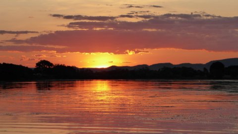
Sunset on the Ord River as we head back into Kununurra. |
|
|
|
|
|
The following day we left Kununurra and headed into the Northern Territory. |
|
|
|
|
|
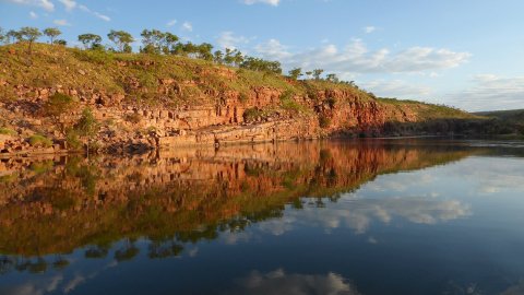
The Victoria River from near the Victoria River Roadhouse. |
|
|
|
|
|
Our tented accommodation close to Nitmiluk National Park near Katherine. |
|
|
|
|
|
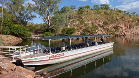
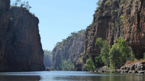
On a two hour boat ride along Katherine Gorge. |
|
|
|
|
|
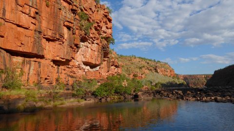
Katherine Gorge. |
|
|
|
|
|
Edith
Falls, a popular swimming hole north of Katherine, and also the end of the Jatbula Track. |
|
|
|
|
|
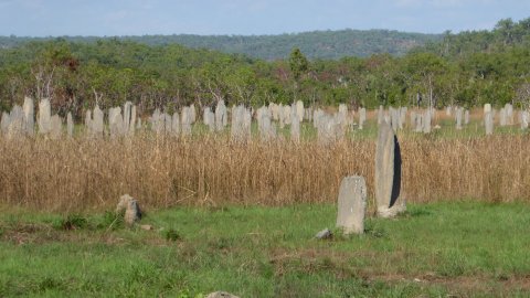
The trip ended in Darwin, but the following day I joined a day trip to Litchfield National Park, which included seeing the magnetic termite mounds. |
|
|
|
|
|
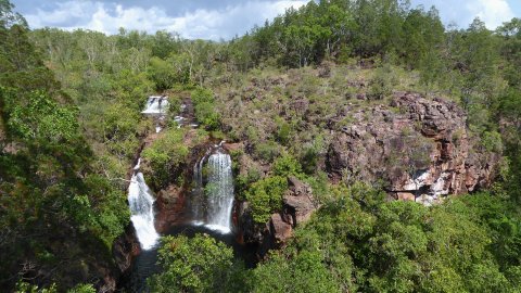
Florence Falls in Litchfield National Park. |
|
|
|
|
|
Wangi Falls in Litchfield National Park. |
|
|
|
|
|
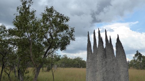
Interesting termite mound. |
|
|
|
|
|
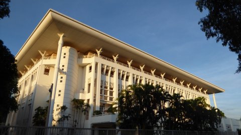
Parliament House in Darwin. |
|
|
|
|
|
Darwin Harbour foreshore from my hotel. |
|
|
|
|
|
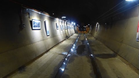
The WW2 Oil Storage Tanks were built into the hillside under the city to store oil. These tanks are
approx 200 metres long and contain interesting photographs from the war. The entrances were
overgrown with vegetation and the tanks were unknown to the public until 1992. |
|
|


![]() Contact "alanlevy at pcug dot org dot
au" for more information.
Contact "alanlevy at pcug dot org dot
au" for more information.
View my other pages: [Home] [Antarctic Peninsula] [Antarctic Flight] [Shackleton Odyssey] [South Georgia] [Easter Island] [Southern Africa] [Galapagos Islands] [Egypt] [Inca Trail] [US National Parks] [Australia] [China] [Cross Country Skiing Photographs] [US & Canada National Parks] [Hawaii] [The Himalayas] [Switzerland]
Related Links: [Kimberley Wild Expeditions]
Page last modified on